


Click on the image for full resolution
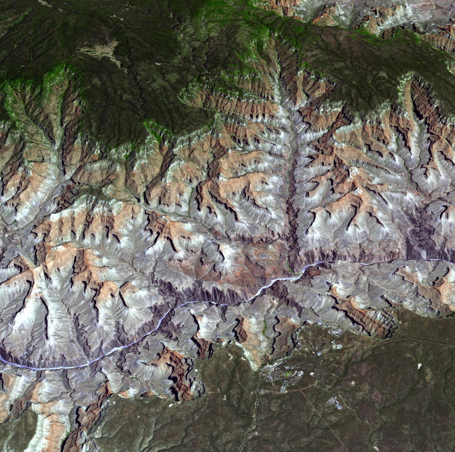
Arguably one of America's most magnificent national parks is the Grand Canyon in northern Arizona. The Aldvanced Thermal Emission and Reflection Radiometer (ASTER) instrument on NASA's Terra spacecraft captured this 3-D view on July 14, 2011, created by draping the ASTER image over a Digital Elevation Model produced from ASTER stereo data. In this perspective view looking to the northeast, the buildings and roads in the center foreground are Grand Canyon Village. The Bright Angel Trail can be seen descending 3,000 feet (914 meters) to Indian Garden, before continuing to the Colorado River far below. Completing the 25-mile (40-kilometer) rim-to-rim hike takes the hiker to the North Rim and the North Rim Lodge. The ASTER image is located near 36 degrees north latitude, 112.1 degrees west longitude. With its 14 spectral bands from the visible to the thermal infrared wavelength region and its high spatial resolution of 15 to 90 meters (about 50 to 300 feet), ASTER images Earth to map and monitor the changing surface of our planet. ASTER is one of five Earth-observing instruments launched Dec. 18, 1999, on Terra. The instrument was built by Japan's Ministry of Economy, Trade and Industry. A joint U.S./Japan science team is responsible for validation and calibration of the instrument and data products.
Credit: NASA/GSFC/METI/ERSDAC/JAROS, and U.S./Japan ASTER Science Team
0 comment(s):
Post a Comment